36
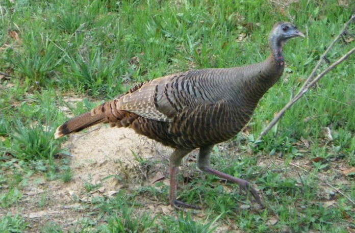
Featured photo by Glynn Harris: A leisurely 50 mph drive along the Natchez Trace could give drivers chances to spot a wild turkey or two alongside the road.
I’ve seen the sign dozens of times traveling east on I-20. The brown Natchez Trace sign just east of Jackson point to where to get on this highway. I’d heard little about driving the Trace to spark my interest, especially the part that mentions the 50 mile per hour speed limit. Compared to the speed we can zip along the interstate, 50 is pokey slow and I like to get where I’m going quicker than 50 will allow.
I made my first trip on the Trace several years ago when a friend and I connected with the highway somewhere around Tupelo and rode it into Alabama, exiting near Sheffield. We weren’t in that big a hurry so the 50 mile per hour drive was rather nice; we even got to watch a flock of wild turkeys feeding along the roadside.
Later, Kay and I were headed southwest from Jackson for a two-night stay in Natchez. The most direct route, according to the map, was to get on the Natchez Trace near Clinton and drive the 80 miles or so to Natchez. It was a drive I’m sorry I avoided before and one I’ll for sure make again in the future.
The only negative was traveling in the middle of a July day when the temperatures approached the century mark. At 50 miles per hour, I’d like to have had the windows rolled down to get a better feel for the peaceful countryside where we drove. Even so, much of the highway was shaded, resulting in temperatures several degrees cooler than that out on the sun-drenched interstate. Another plus to our trip was the absence of traffic; we probably saw fewer than two dozen vehicles over the 80 mile span.
Upon returning home a few days later, my interest in this neat little back country highway sent me to cyberspace for some research on the Natchez Trace. What I found was fascinating.
Did you know that the Natchez Trace is some 444 miles in length, stretching from Natchez, Mississippi to Nashville, Tennessee?
Do you know how the Trace was formed? I didn’t but I learned that in the early 1800s, boatmen called “Kaintucks” from the Ohio Valley floated merchandise, agricultural products, coal and livestock down the rivers for sale in Natchez and New Orleans. Once the trip was completed, the flatboats were dismantled and the lumber sold.
Next came the arduous task of getting home via the ancient trail used by animals and humans that connected Natchez to just south of what is Nashville. If the sale of lumber was enough to purchase a horse, the Kaintucks rode back along the trail, the trip taking 20-25 days. If there was no horse, they walked, covering the distance in 30-35 days. A trip around Wal-Mart gets me winded so it’s hard to imagine walking a trail for nearly 500 miles through sometimes hostile Indian territory where robbers often lurked with no Golden Arches or Holiday Inn anywhere to be seen.
The trail became so well used that research indicates as many as 10,000 travelers used the old Trace in 1810 alone and by then, the Trace was the most heavily traveled trail in the Old Southwest. By 1820, more than 20 inns, or “stands” were in operation along the Trace, offering food and shelter.
The modern Natchez Trace Parkway was begun in the 1930s, paralleling the old Trace. Today, the parkway is complete, giving travelers an unhurried route from Natchez to Nashville where you won’t see many other vehicles but you just might spot a flock or two of wild turkeys or herd of deer.


